
Kurnell to Cronulla: a day on the Botany Bay coast
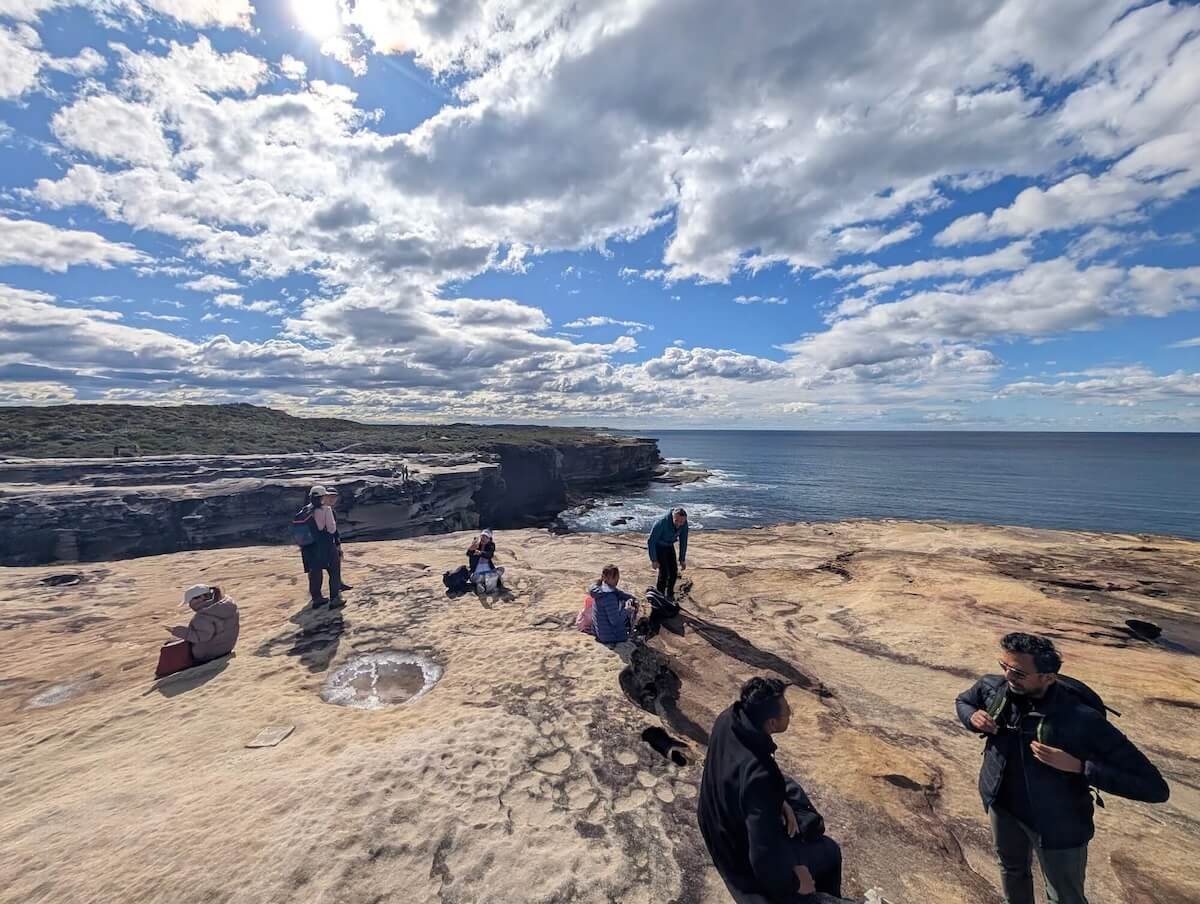
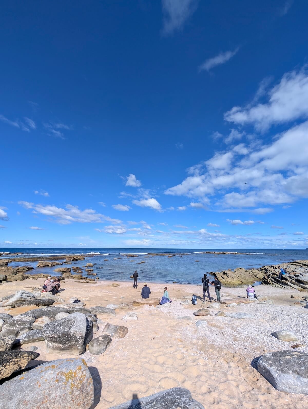
On Sunday, 23 August, we walked the Botany Bay coast from Kurnell to Cronulla, and it was spectacular. Our day took us from the foreshore at Kurnell to Cape Solander, past Cape Baily lighthouse and along the beach towards Cronulla.
I also used TrekMeet during the walk. It was still in beta, and I followed the trail in the app as we went. After spending so much time building it, I wanted to use it on the kinds of days it was made for: out with the group, following a route and enjoying the walk.
This is a little of that day, along with the route we planned and a few things to check if you would like to walk the coast yourself. It is a full day on foot, with different surfaces along the way and a long beach section towards the end.
Getting to Kurnell
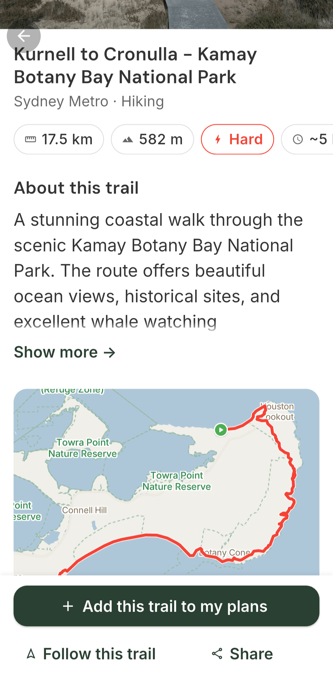
Our planned meeting point was the bus stop on Prince Charles Parade, opposite Kurnell Post Office, after 9 am. It is served by route 987 from Cronulla Station, running hourly on Sundays. Check the current timetable before travelling. We planned to finish near Cronulla Station late in the afternoon, so people could catch the train home.
The day was organised as a one-way walk. We would begin on the Botany Bay side of Kurnell, make our way around the coast and finish at Cronulla. Having that shape to the day made it possible to plan the start and finish around public transport.
From the foreshore towards Cape Solander
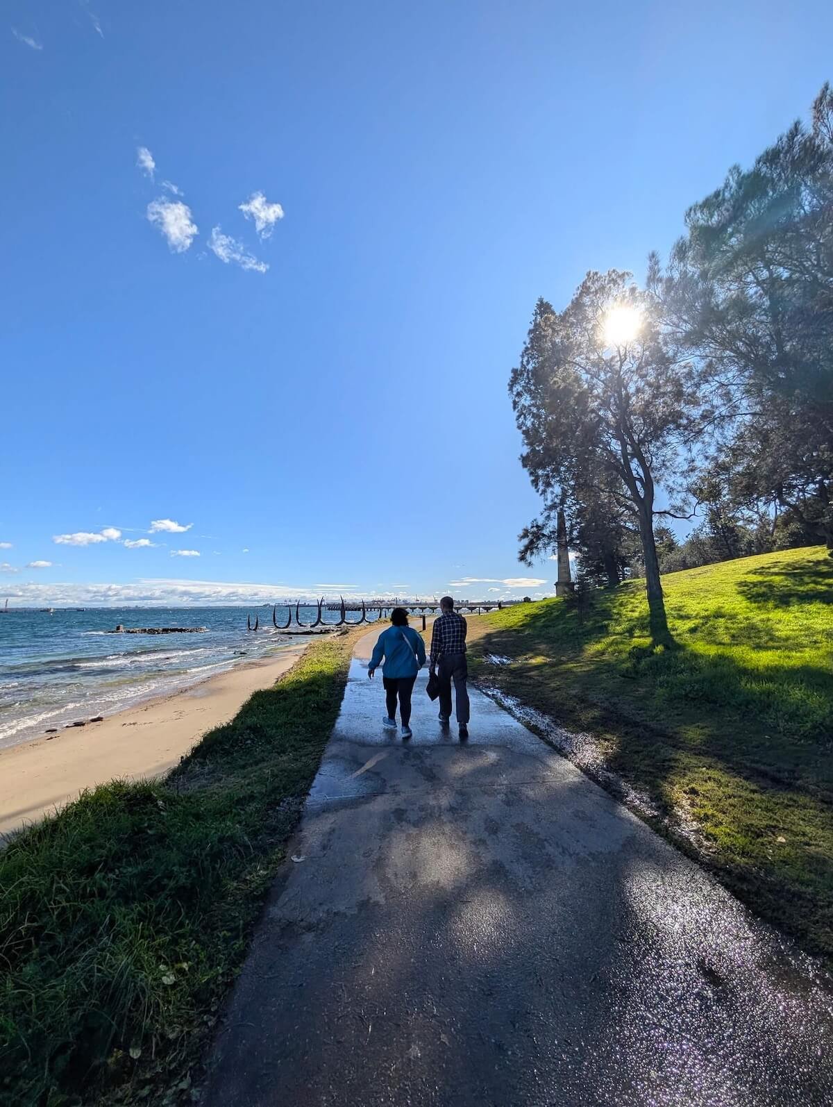
The first part of our plan followed Prince Charles Parade and the foreshore, taking the Monument Track past Captain Cook’s landing place. From there, we had the Muru trail and Cape Solander in our route before continuing along the coast.
There is more to this area than a starting point for the longer walk. Kamay holds the history of the people who were here long before Cook’s arrival, as well as the events marked by the landing place. If you have time, read the interpretation along the foreshore rather than walking past it just to reach the headland. NSW National Parks has more about the landing place.
From the foreshore, the route moves into a different part of the Kurnell landscape. The Muru and Yena tracks pass through bushland in the national park. Our longer plan continued towards Cape Solander before heading south along the coast.
Cape Solander and the walk to Cape Baily
Cape Solander was one of the main stops in our plan. From there, the route continued towards Cape Baily lighthouse. This is the part of the outing where the coastline becomes the focus, with the lighthouse giving you a clear place to look forward to along the way.
The official name is the Cape Baily walking track. The National Parks description covers the section from Cape Solander to Potter Point, with the lighthouse along the route. That named track is one part of the longer Kurnell-to-Cronulla day, so its distance should not be mistaken for the length of the whole walk. Cape Baily walking track.
The lighthouse is a useful landmark in the middle of a longer day. Beyond it, our plan continued towards Boat Harbour and the beach, so reaching Cape Baily was one stage of the walk rather than its finish.
Using TrekMeet along the way
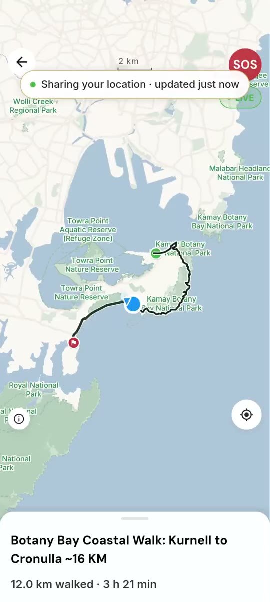
This screenshot is from during our walk. TrekMeet shows 12.0 km walked and 3 hours 21 minutes at that point, with the route and my position on the map. It also shows that live location sharing was active when the image was taken.
This was partway through the day, so those are not our final totals. The event title’s approximately 16 km was the estimate in the plan.
I followed the trail in TrekMeet as we walked. For me, using it with the group is an important part of building it. The route and the people are there together, and I can see how the app fits into an ordinary day outdoors.
The screenshot also leaves a small record of where I was when I took it. Paired with photographs from the walk, it is something I can return to later and remember the day. The screen gives the route some context; the pictures show the places along it.
Continuing past Boat Harbour
After the lighthouse section, our route went past Boat Harbour Aquatic Reserve before reaching the long stretch of beach towards Cronulla. It changes the feel of the walk again. The coastal tracks give way to a sustained walk on sand, with the finish still ahead.
The aquatic reserve protects part of the coastal marine environment south of Kurnell. It is another change of setting on a route that includes the bay foreshore, bushland, the headland and the beach.
The beach towards Cronulla
The beach was the final long part of our Kurnell-to-Cronulla route, with the station as the planned finish. One of the practical things about this walk is being able to organise the day around public transport rather than returning to a car at the starting point.
The beach gives this route a different ending from a walk that doubles back along the same track. The setting keeps changing as you make your way towards Cronulla. That variety is part of what I wanted to capture in this first journal, alongside the app image from the day.
If you would like to walk it
The invitation described the walk as roughly 16 km, and we planned for a full day. Use a current route map to judge the distance and effort of your own version. The combination of coastal paths, rocky surfaces and sand matters as much as a number beside the route name.
Check the weather and current Kurnell park alerts before setting out. Access arrangements can change. Follow current signs and official access advice rather than an older itinerary or social-media post.
Check the current 987 bus service or use Trip Planner before travelling. Follow signed public tracks and check access around Boat Harbour. Carry water, food and sun protection: National Parks notes that the Cape Baily track has no drinking water or shade. Have your route downloaded before leaving coverage.
We used TrekMeet to schedule and track this walk, and all our future hikes are scheduled on it. Search for OZ Outdoors under public groups in TrekMeet to see our upcoming events, or make a solo plan or host a walk of your own. If you try the Kurnell-to-Cronulla coast, I would like to hear how your day went.