
Less Screen Time. More Green Time.
One app for the
whole outdoors.
TrekMeet brings the plan, map and group conversation together for your day outdoors.
Prepare for your walk
Choose a trail and save its map before you leave coverage. With a usable GPS signal, you can see your position and surrounding mapped paths within the downloaded area. You can also import a GPX route to use on your phone. An imported GPX route is not included in the plan’s share link and is not available on other members’ phones.
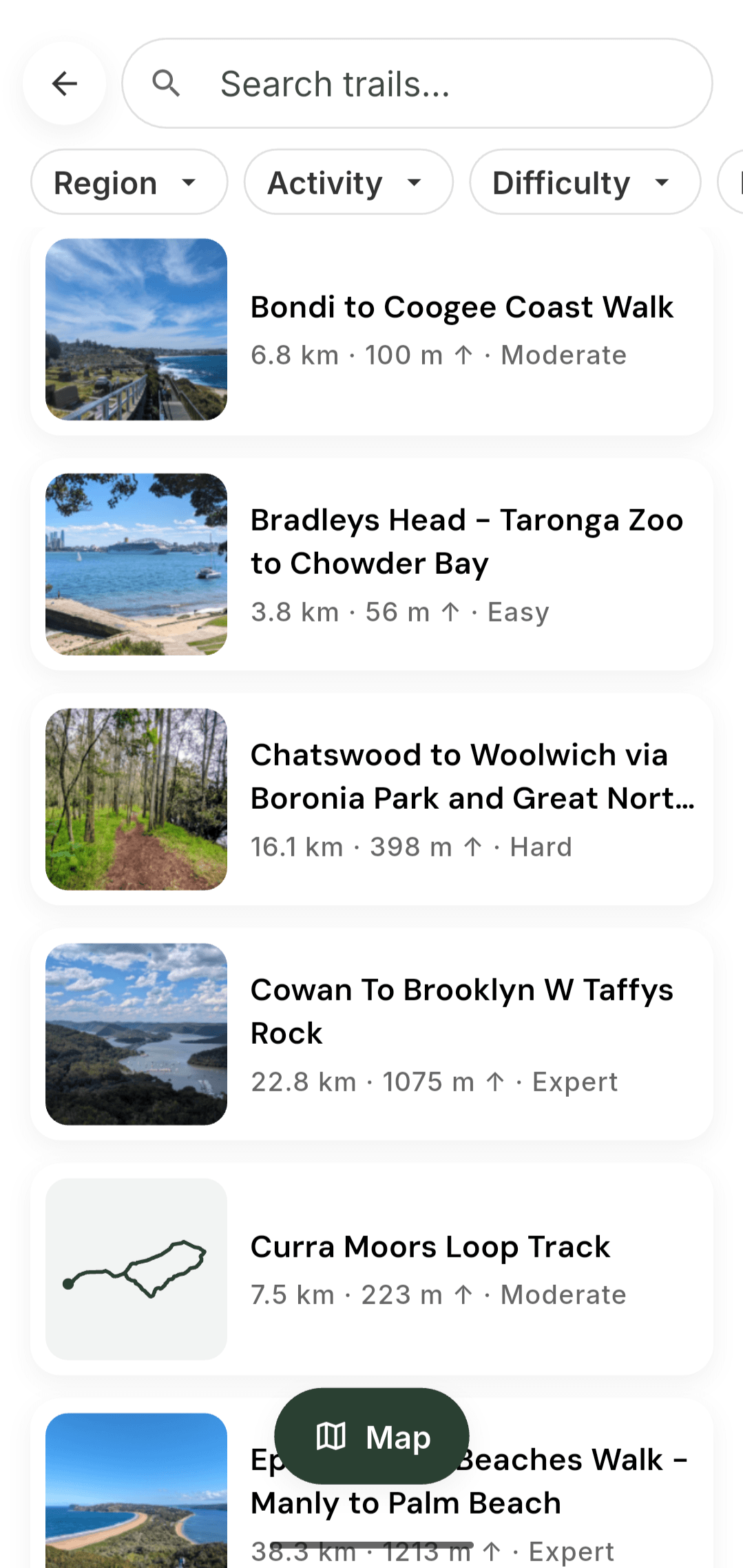
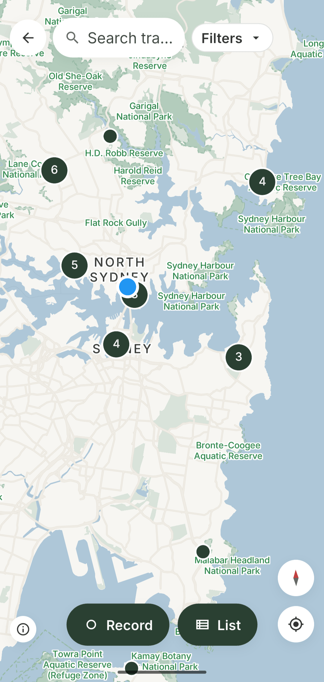
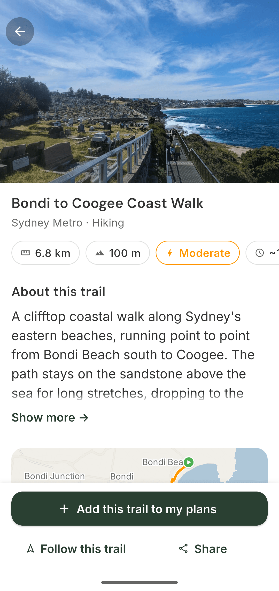
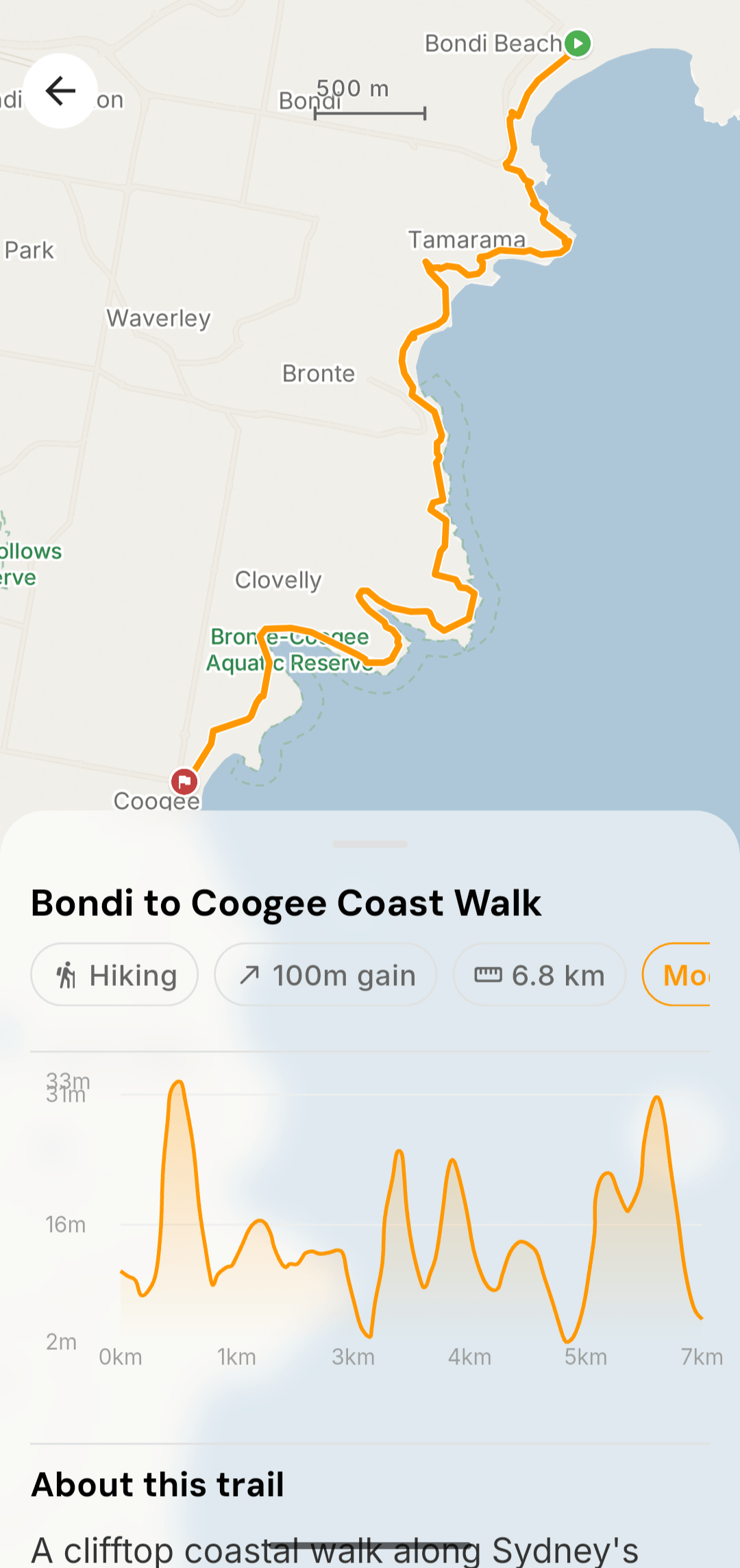
Distances and elevation shown here describe the planned library route. TrekMeet Maps use MapLibre and map data © OpenStreetMap contributors.
In Practice
Maps, walks and your group
See where you are on the trail
When following a route loaded on your phone, see whether you are on it and your approximate distance from it. Recording keeps the path you walk, along with distance and time.
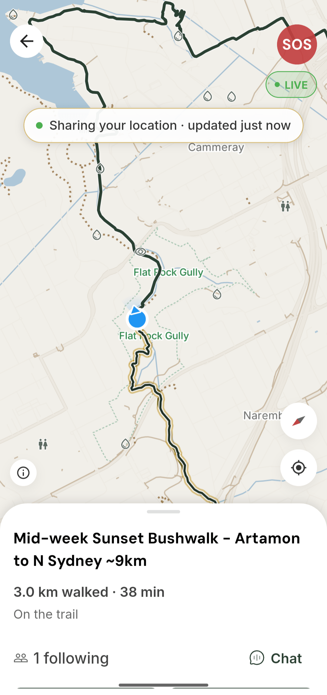
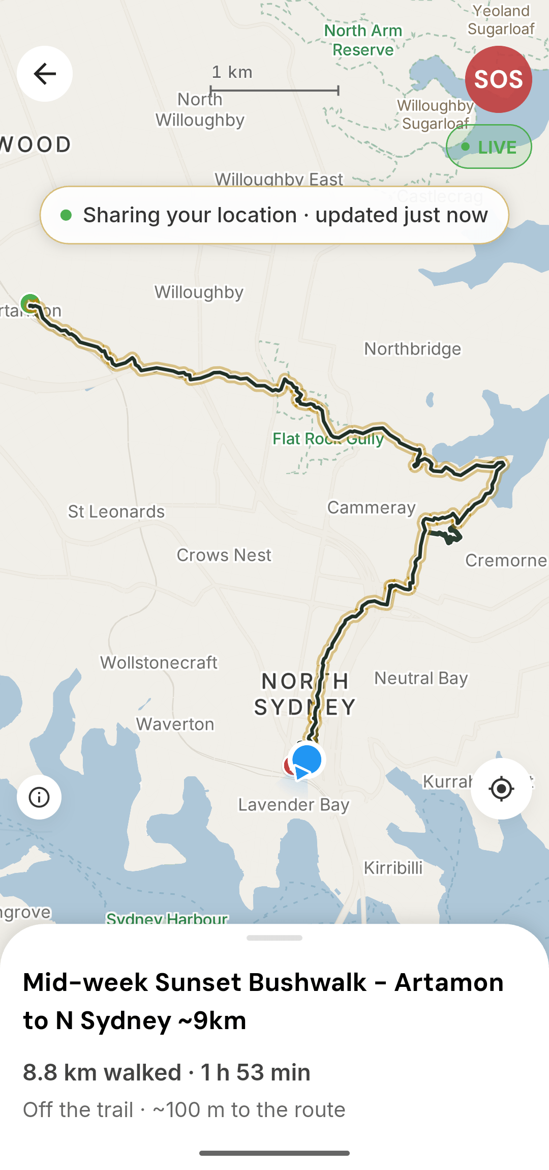
These screenshots show a group walk with live sharing active. Live updates need a connection. Recording your own walk does not automatically share your location.
Your Journey
Keep and share your walk afterwards
Save your recording to your Journey and choose whether to share a browser preview. Your saved recording stays on the phone used to make it. Event walks sync their confirmed distance and time with the event. When you share a walk, its summary can include the title, distance, time, any climb figure and a route image.
Saved walks in the Journey tab.
Make plans with your group
Create or join a group and use its chat to make plans. The group’s owner and co-organisers can create events, with event chat for the organiser and attendees.

Live Trek
See where your organiser is
Adult organisers can choose to share their position with attendees during a group walk. Live updates need a connection. Check when the position was last updated, especially where reception is patchy.
TrekMeet does not watch your walk and cannot send help. In an emergency, call 000.
The organiser’s Live Trek view during a walk.
TrekMeet Maps use MapLibre and map data © OpenStreetMap contributors.
How we plan to support TrekMeet
We plan to support TrekMeet through annual subscriptions, with more planning and recording options for walkers and additional tools for organisers.
All current features are free through 7 November 2026. Annual subscriptions are planned to start with Explorer on Sunday 8 November 2026, once purchasing is ready. Trail Leader is planned to follow when its organiser tools and purchasing are ready. Offline base maps, taking part in groups and the existing safety tools stay free under this plan.
| Capability | Free | Explorer | Trail Leader |
|---|---|---|---|
| Annual price | A$0 | A$35 in 2026; A$49 from 2027 | A$99, including Explorer |
| Discover, join, apply, RSVP, chat and sync | Included | Included | Included |
| Trail Bonds and follows | Included | Included | Included |
| Offline base maps, trail downloads and regions | Unlimited | Same | Same |
| Safety, screening, applications, transfer and moderation | Included | Included | Included |
| Active solo plans | 1 | Unlimited | Unlimited |
| New GPX route imports | — | Included | Included |
| Spontaneous recording starts per calendar month | 2 | Unlimited | Unlimited |
| Event-linked recording, saved walks and basic metrics | Included | Included | Included |
| Advanced on-walk progress, including remaining route distance | — | Included when activated | Same as Explorer |
| Satellite, detailed topo and hillshade | — | Future | Same as Explorer |
| Advanced Journey comparisons | — | Future candidate | Same as Explorer |
| Profile, group cover and event cover photos | Included | Included | Included |
| New Journey and chat photos per calendar month | 10 shared | Unlimited monthly uploads | Same as Explorer |
| Photos per Journey record / chat message | 6 / 6 | 6 / 6 | 6 / 6 |
| Groups owned | 1 | 1 | Up to 5 |
| Members per group | 50 | 50 | Unlimited |
| Published events per group per calendar month | 4 | 4 | Unlimited |
| Co-organisers and paid organisation tools | — | — | Included |
| Meetup event import | — | — | Future |
| Event/calendar integration, recurring events and organiser analytics | — | — | Future |
| Ordinary group communication and factual attendance information | Included | Included | Included |
| Donations and tips | Not tier-gated if delivered | Same | Same |
| Recurring-payment collection methods | — | — | Future |
Future features are not available yet. Plans and timing may change.
Prices in this plan are annual, in Australian dollars including GST, as shown by the store when you buy. Under this plan, a 2026 Explorer purchase gives you a full year at A$35. New purchases from 1 January 2027 are A$49. A 2026 buyer renews at A$49 on their anniversary, subject to the store’s notice and consent requirements. There is no extra charge in January during that first year.
The ten-photo allowance is shared across Journey and chat. Profile and cover photos do not count. Recording allowances count successful new spontaneous starts, not pauses, resumes, recovery or saving a walk. Calendar months reset in Sydney time, with no rollover. Access to saved records and existing photos stays free under this plan. Group allowances follow the owner’s plan; authorised helpers do not each need a subscription. The plan has no monthly launch option.
The first 11,000 eligible accounts created in the app before 8 November 2026 (Sydney time), including existing accounts, get Explorer free for their first year, from 8 November 2026 to 7 November 2027, with no payment, card or automatic renewal. Signing up for website emails does not create an app account. From 8 November 2027, you can choose whether to subscribe at the store price then shown. Read the promotional-access terms.
Read the values behind TrekMeet
Take TrekMeet on your next walk.
Make a plan with people you know, or find a group to walk with.