
About TrekMeet
TrekMeet helps people connect through outdoor experiences. You can create a group and organise events, join a local group or plan a hike on your own. Chat with your group and keep a record of your walks.
Choose an Australian trail from the TrekMeet library or import your own GPX route. Download the map and load your route before heading out to use them without mobile reception.
It is available in Australia on iPhone and Android, for people aged 16 and over. It is free to download and has no ads.
Why I started TrekMeet
I'm Manish, the solo founder of TrekMeet. I have 20 years of experience in software, and I'm also a volunteer trail leader and bushwalker based in Sydney.
I've run OZ Outdoors, a Meetup group in Sydney, since 2020 and have led over 450 walks across NSW and other parts of Australia. The group has grown to more than 3,000 members. I'm now moving our walking community to TrekMeet.
For a group walk, the organiser needs to bring together the people, the route, meeting details and the conversation before everyone heads out. Running OZ Outdoors often meant keeping the event on one platform, the route in a maps app and updates in a separate chat. A change to the plan could mean repeating the same information in several places, while people joining still had to find the details and prepare their maps.
I could not find one platform that suited the way our outdoor community worked, with group and event management, conversations and maps we could save before heading out. I also wanted reliable tools with manageable costs and clear privacy choices for the people joining our walks.
TrekMeet grew from that need. It brings groups, events, conversations and offline trail maps together, with ways to connect as trail mates, follow other hikers and keep a record of walks in Journey.
I started building TrekMeet in June 2025, and the way I work with AI agents has evolved along the way. The product grew out of my experience of leading walks and listening to the people who join them, whose feedback continues to help me decide what needs improving.
Who TrekMeet is for
TrekMeet is built for people who enjoy spending time outdoors, allowing them to join a group or head out on their own.
- People joining walks can find events, read the details, RSVP and talk with the group.
- People organising walks can bring their group, event details and conversations together.
- People making their own plans can choose a trail, use a GPX route on their phone and record the walk.
TrekMeet began with a vision to support the hiking community by bringing planning, offline maps and chat together in one place. It now supports 18 outdoor activities, including hiking, camping and trail running.
The aim is to make planning and taking part easier, starting with communities in Australia and growing as people use the app and share their feedback.
Prepare your route and maps
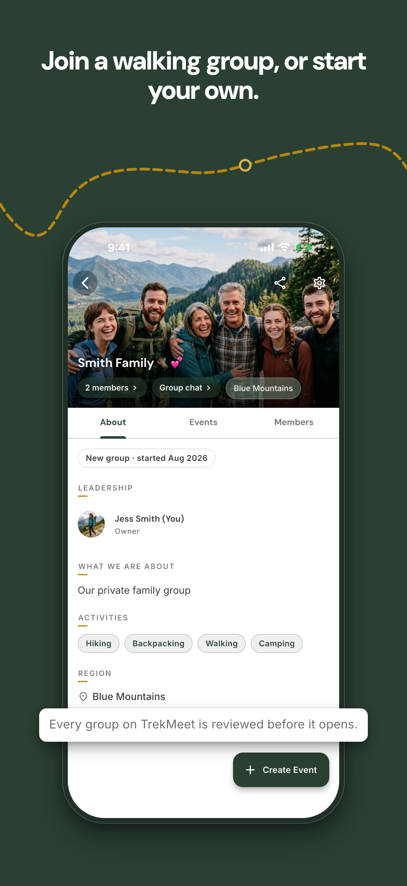
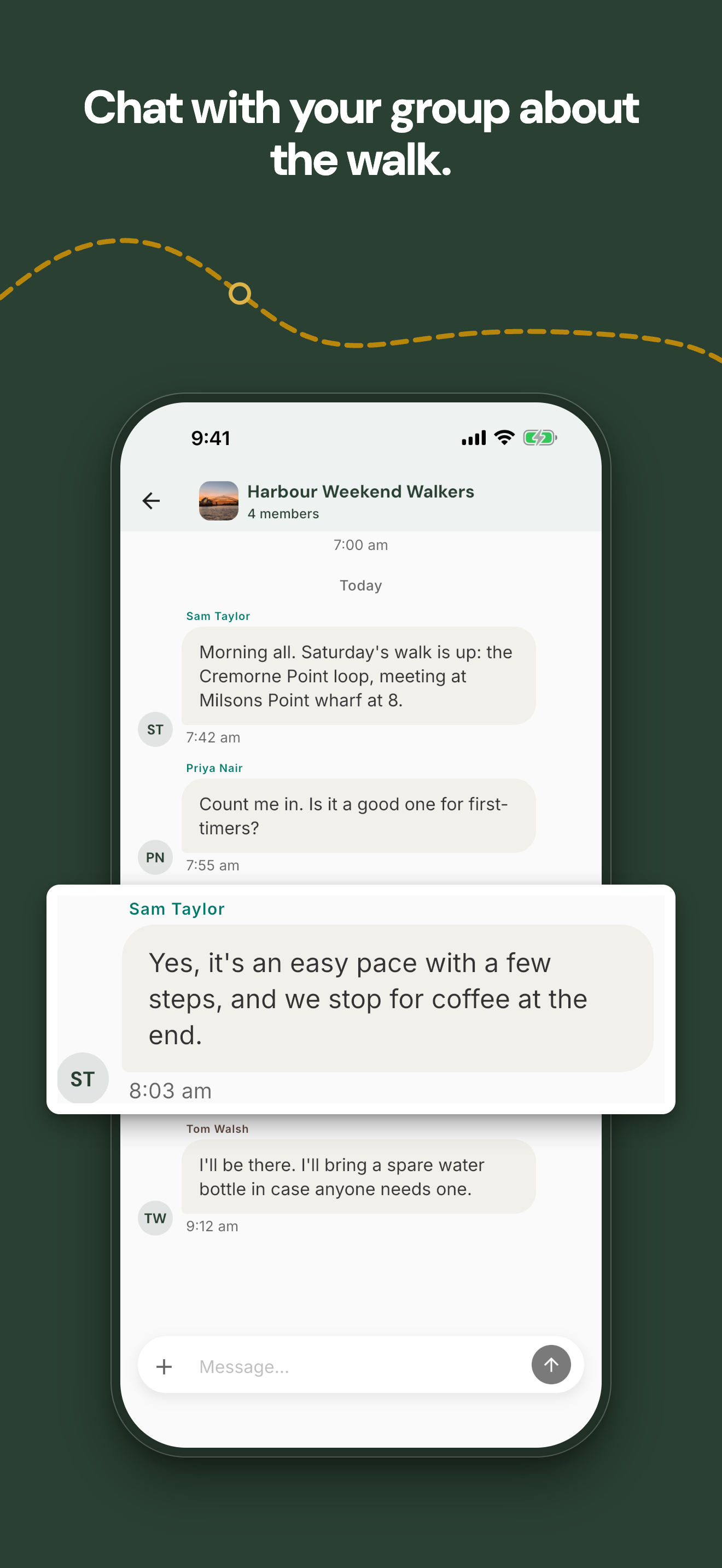
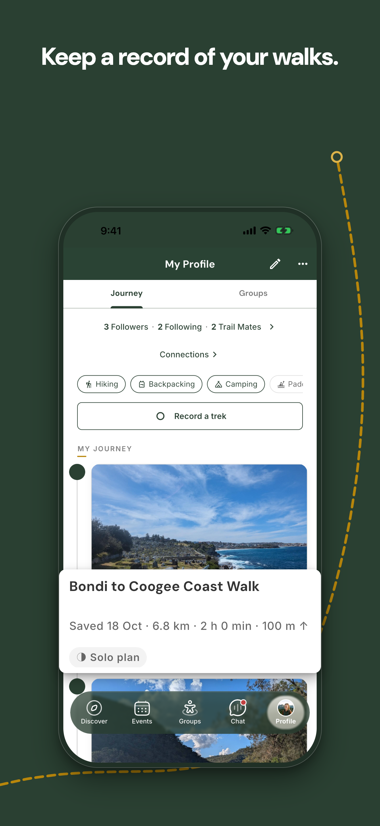
These app images show a trail, a group, a conversation and a saved walk. The people and groups shown are sample accounts prepared for the screenshots.
The TrekMeet Library includes Australian trails and some of the routes I have led with OZ Outdoors, with details about each trail's planned distance and elevation.
TrekMeet offers free offline maps, which you can save before heading out. With location permission and a usable GPS signal, you can see your position and the surrounding mapped paths within the downloaded area, even without mobile reception.
Following a particular route also requires that route to be loaded on your phone, as saving a map does not save every trail route within it.
You can import a GPX route to use on your own phone. An imported route is not included in the plan's share link and is not available on other members' phones through that link.
TrekMeet Maps use MapLibre and map data © OpenStreetMap contributors.
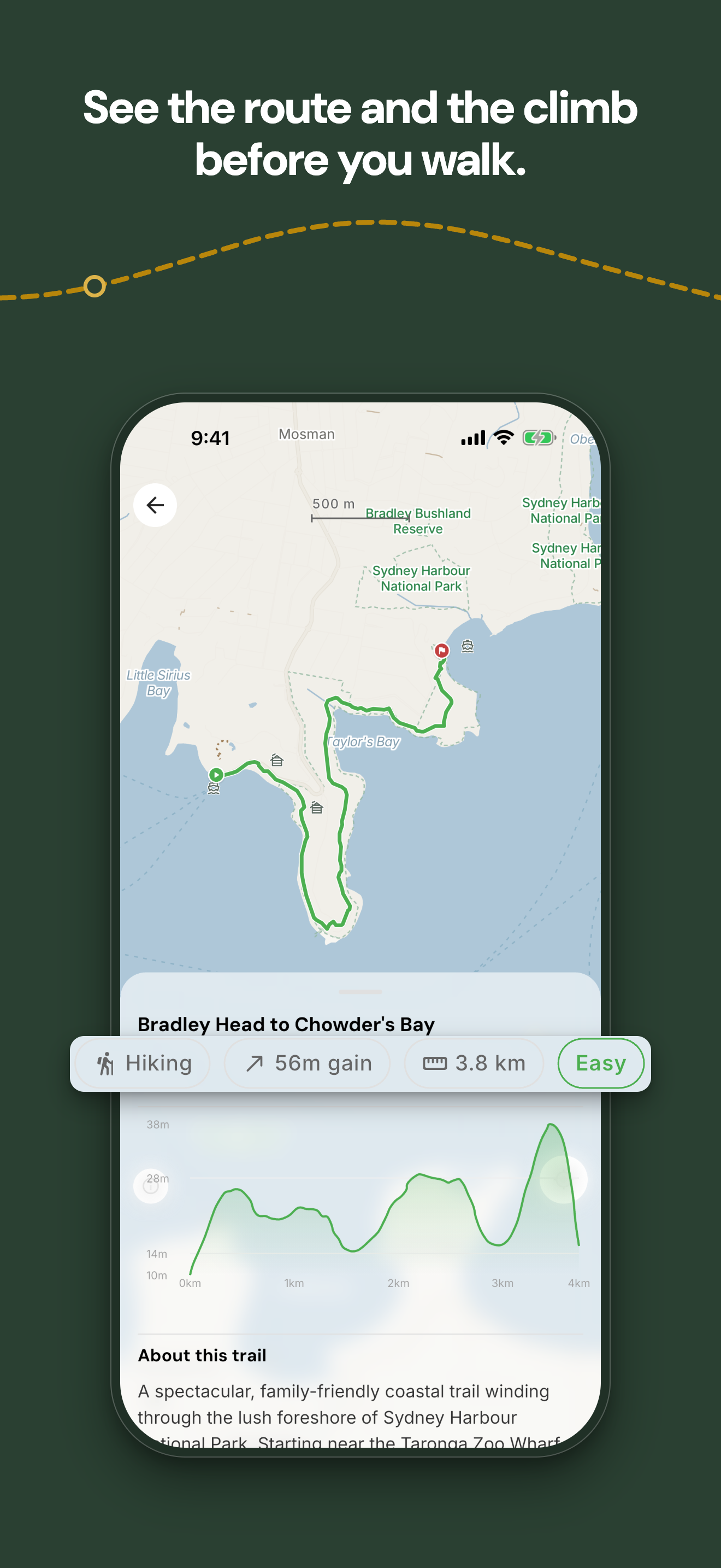
Make a plan or organise a group walk
TrekMeet lets you create a solo plan without joining a group by choosing a trail or importing a route and adding the details. The plan stays in Events, and you can share its details through a link.
For group walks, the owner and co-organisers can create events with a meeting point, distance, difficulty and other information, allowing members to read the details and RSVP. The organiser and attendees can then use the event chat to discuss the walk.
Groups have their own information, membership process and chat. Event and solo-plan reminders follow your notification settings.
Keep the conversation with the walk
Group and event chats help people discuss their plans and share updates, with photo sharing available in group chats and direct messages. Each message shows the time it was sent, and you can save a shared photo to your phone on an iPhone or on Android 10 or later.
Trail Mates are people who have chosen to connect with each other, and direct messages follow the recipient's settings, with Trail Mates only as the default. Sending messages and photos needs a connection.
Record and remember your walk
TrekMeet lets you record the route you walk, along with distance and time, and save it to your Journey afterwards. Recording can work without mobile reception when location permission and a usable GPS signal are available.
Your saved recording stays on the phone used to make it, while event walks sync their confirmed distance and time with the event. Plans stay in Events, and Journey holds the walks you have recorded.
Saved walks can be shared through a browser preview or a share card image, with a summary that can include the title, distance, time, any climb figure and a route image.
See where your organiser is
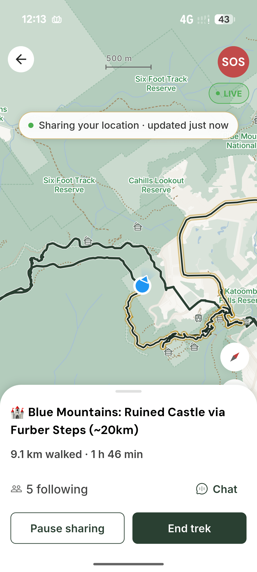
Live Trek allows adult organisers to share their position with attendees during a group walk. These updates need a connection, so it helps to check when the position was last updated, especially where reception is patchy.
Recording your own walk does not automatically share your location.
On the trek screen or a live event's page, press and hold SOS for options to call 000, call your saved emergency contact or share your location. Calls and sharing need a connection.
TrekMeet does not watch your walk and cannot send help. In an emergency, call 000.
Choose what you share
TrekMeet keeps the app free of advertising and data sales, and gives you sharing choices and profile settings to control how you connect with other members. Information about how data is used and shared, including the services that help run the app, is explained in the Privacy Policy.
TrekMeet is for people aged 16 and over. Members aged 16 or 17 receive messages from trail mates only. They can record walks privately, but cannot share live location or publish walks to followers, and are not shown in people search.
Members can report content and block other members, with each report reviewed by a person. New groups are checked against content standards before they open. Members still need to assess whether a walk and its organiser are suitable for them, as TrekMeet does not verify an organiser's qualifications or an event's safety.
How TrekMeet is supported
TrekMeet has a Free plan and an optional annual Explorer plan. Offline base maps, taking part in groups, core chat and the existing safety tools stay free. Subscriptions are intended to support more personal planning and recording tools and additional options for organisers.
| Plan | Who it is for | Planned role |
|---|---|---|
| Free | People joining walks or making occasional plans | Group participation, core chat, unlimited offline base maps and allowances for personal planning, recording and photo uploads |
| Explorer | People who want more personal planning and recording options | More solo plans and recordings, GPX imports and additional personal tools as they become available |
| Trail Leader | People running outdoor groups | Everything in Explorer, with more group capacity and additional organiser tools when they are ready |
Your plan in the app shows the options available to your account. Trail Leader’s additional organiser tools and purchasing remain planned.
The plans, prices and allowances are explained on the Product page, and the purchase conditions are set out in the Terms of Use. You must be 18 or over to buy a subscription.
The intention is to support the ongoing work on TrekMeet through subscriptions while keeping it useful for people who simply want to join a walk or use an offline base map.
What we want to improve next
Feedback from people using TrekMeet helps decide what to work on next, with the latest plans shared on the public roadmap.
Alongside the subscription work, the roadmap includes improvements to everyday use:
- Organising walks: more ways to share the work of running an event, manage a waitlist and keep track of who attended.
- Recording maps: better map behaviour as your position and direction change during a walk.
- Journey controls: more control over who follows your Journey.
- Offline photos: allowing photos added after an offline walk to upload when you reconnect.
These improvements are being considered for future updates and are not available in the app right now.
Further ahead, the ideas include:
- More map choices, including satellite imagery, detailed topographic maps and hillshade.
- Organiser tools on the web, recurring events, organiser insights and importing event details from Meetup. Importing member lists is not planned.
- AI-assisted suggestions for walks and plans that members can review and choose for themselves.
- Community trail contributions, Apple Watch and Garmin support, and coastal information such as tides and moon phases.
The plans and ideas above are part of the roadmap and are not available in the app right now. Their timing may change as we hear from members and work through what each feature needs.
TrekMeet is currently available in Australia, with plans to expand to more countries in the first quarter of 2027. People elsewhere can leave their email on the website to hear when it becomes available.
Built with a walking community
OZ Outdoors has been part of TrekMeet from the beginning, with people on our walks helping me understand what is useful, what is confusing and what still needs work.
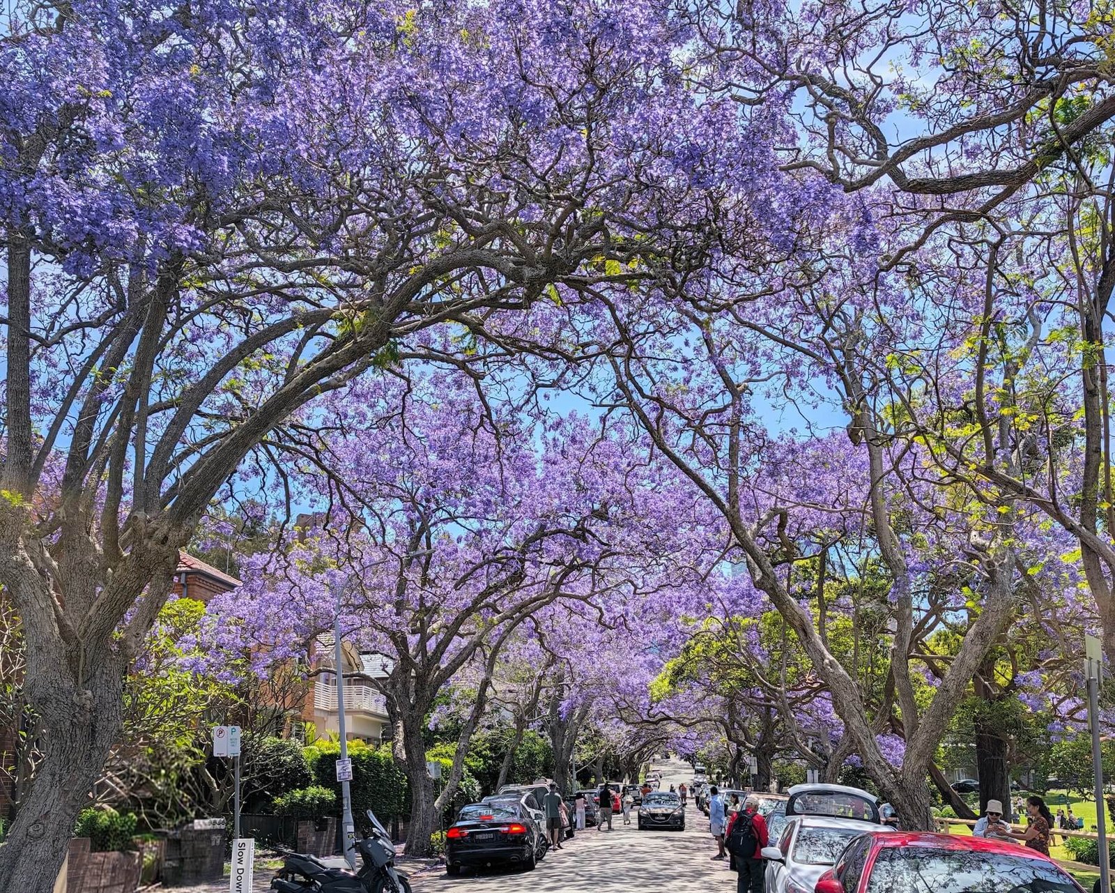
On Saturday 31 October 2026, we hosted a free OZ Outdoors jacaranda walk from Milsons Point to North Sydney with over 30 people. We also celebrated TrekMeet's launch and used the app to organise and record the walk.
Our recorded route was 9.9 km. We later shared the route, photographs and favourite jacaranda stops in a short guide on the website.
Read the jacaranda walk journal.
I continue to use TrekMeet on the walks I lead, which gives me a regular chance to see how it works outside, alongside the people it is being built for.
How TrekMeet is built
I build and run TrekMeet myself, with help from AI agents across development, design, testing, writing and day-to-day work, and the way I use them has changed as the product has grown.
I started on an eight-year-old Windows laptop and used different tools along the way, gradually building a process around written plans, review and testing. I make the product decisions, review the work and test changes on real phones before releasing them.
TrekMeet uses a shared mobile codebase for iPhone and Android. Saved maps and plans can be used on the phone without mobile reception, while cloud services support accounts, groups, events and conversations when connected. Different kinds of information have different storage and sharing rules, as described above and in the Privacy Policy.
I use feedback from members and my own experience of leading walks to decide what to build and improve.
The Solo Founder Operating System
Over time, I want more of the routine work involved in running TrekMeet to come together in one place, including development work, feedback, support enquiries and community reports.
The longer-term idea is for agents to prepare a daily overview, with recommendations and an indication of how confident they are. I would review the items, approve, change or defer them, and keep responsibility for the decisions.
Some parts of this are still planned. Important actions will continue to need my review.
Company and contact
| Detail | Information |
|---|---|
| Product | TrekMeet |
| Company | TrekMeet Pty Ltd |
| Founder | Manish Kumar |
| Project began | June 2025 |
| Company incorporated | 10 August 2026 |
| Based in | Sydney, Australia |
| ACN | 701 247 145 |
| ABN | 96 701 247 145 |
| Availability | Australia, on iPhone and Android |
| Minimum age | 16 |
| Website | trekmeet.com |
| Contact | hello@trekmeet.com |
Download TrekMeet from the App Store or Google Play.
For current product details, visit the Product page. For press assets and company information, visit Media. You can also find TrekMeet on LinkedIn.